 Skip to main content

As the UK’s leading energy port, Milford Haven serves as a busy gateway for ships, crew and cargo. The UK Hydrographic Office (UKHO) has been working closely with the Port of Milford Haven to develop more precise digital chart coverage and help mariners overcome navigational challenges in the area.
About Milford Haven Waterway
Situated on the coast of South West Wales, the Port of Milford Haven is one of the deepest natural harbours in the world. The port serves some of the world’s largest vessels, as well as being a busy shipping channel for fishing boats, barge movements, recreational users, and a twice-daily passenger and freight ferry that connects Wales to Ireland.
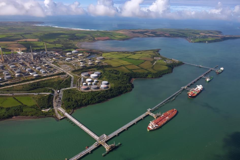 Each day, the Milford Haven Waterway is navigated by large commercial vessels including Very Large Crude Carriers (VLCCs), Liquefied Natural Gas (LNG) carriers and bulk cargo carriers. The Port of Milford Haven is the UK’s third largest port by tonnage, handling 1,957 commercial vessels and 38.9 million tonnes of cargo during 2022.
It also fulfils a vital role for the UK economy as a major energy port. It is home to two LNG terminals (supplying a third of the UK’s gas), one of Europe’s largest oil refineries (supplying over 14% of UK transport fuel) and a Combined-Cycle Gas Turbine plant (powering around 4 million homes).
Now, with investment in the Celtic Sea renewables opportunity advancing dramatically, developers are working on large-scale floating offshore wind farms, as well as tidal and wave technologies - with the Waterway already test-bedding new hydrogen initiatives.
Understanding the navigational challenges
With so many vessels – both large and small – making use of this historic waterway, supporting safe and efficient navigation is a complex but crucial task.
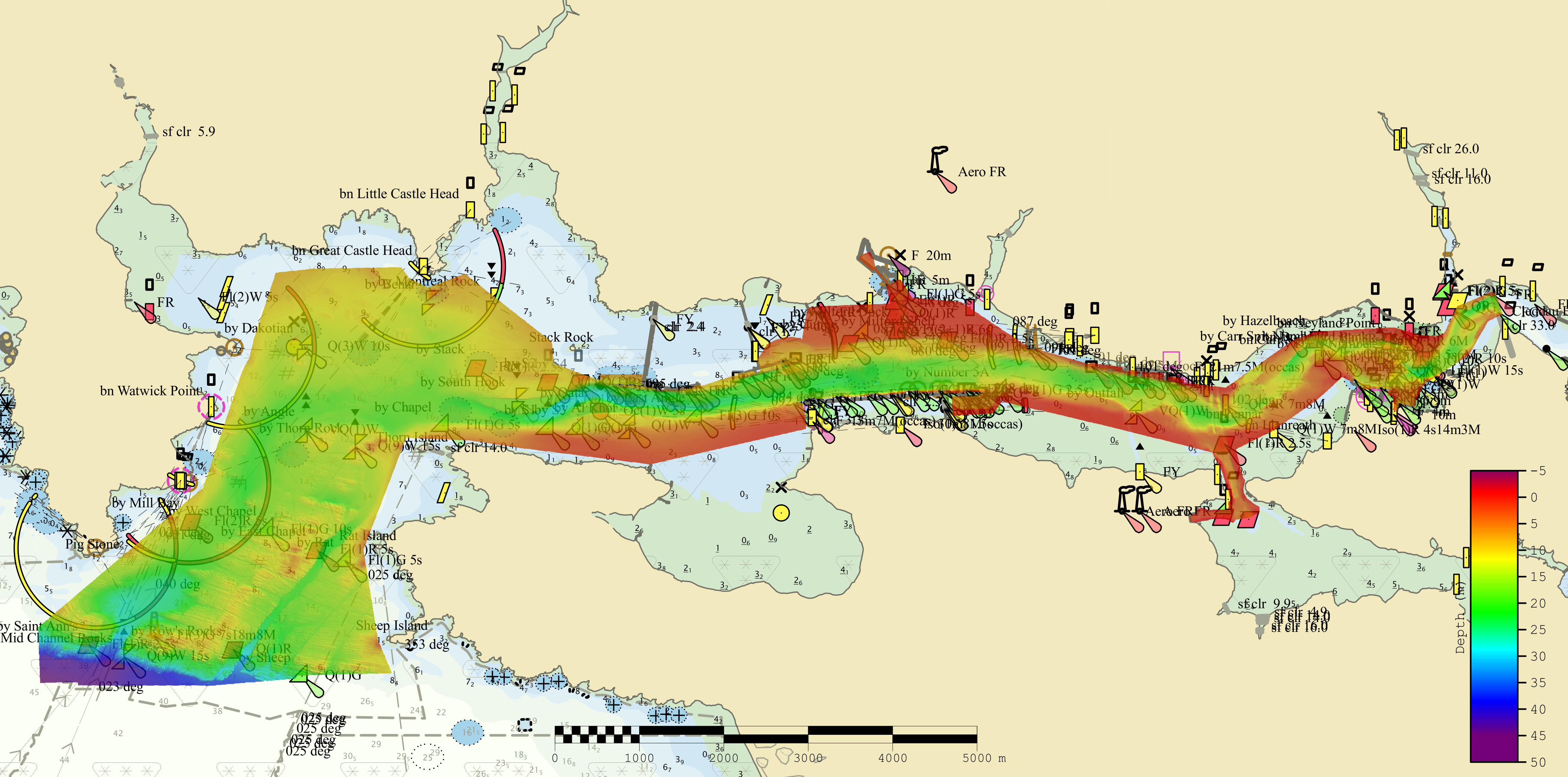
The Milford Haven Waterway offers 22 miles of navigable water with an average depth of 15.5m; but as with any busy waterway, the area has its own unique navigational challenges.
Despite being one of the deepest natural harbours in the world, large commercial vessels must navigate carefully through its narrow channels – requiring deep-draught vessels to keep strictly on track with limited manoeuvrability. In some areas, the channel width is reduced to under 200m, meaning that only one large vessel can move at a time. Here, the under-keel clearance can be as little as 1m, requiring skilled navigation and a confident understanding of the true depth of water underneath the keel.
Where the channels narrow, this can create navigational ‘pinch points’ – particularly for congested areas where both inbound and outbound vessels are changing their course. These areas can be particularly challenging in certain conditions due to the strong tidal currents and heavy swell.
Enhancing navigation with HD ENCs
To transit this busy and narrow waterway, detailed navigational information is needed for mariners to make safe passage with confidence and precision.
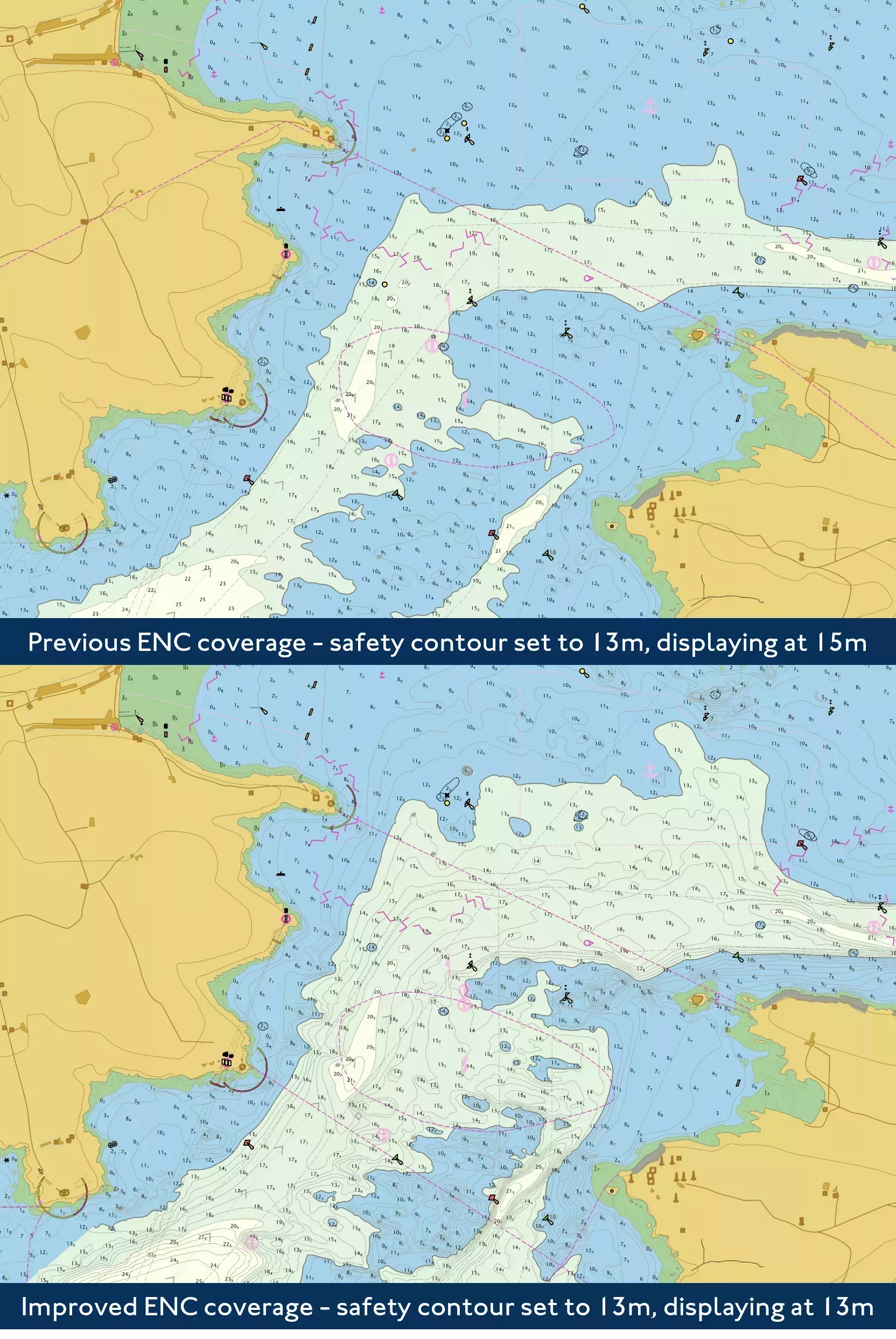
This navigational precision is something that is afforded by ‘high-density’ Electronic Navigational Charts (HD ENCs). HD ENCs are contoured at one-metre intervals, enabling users to choose the most appropriate safety contour for the draught of their vessel and allowing them to navigate safely through high-traffic, shallow waterways such as Milford Haven.
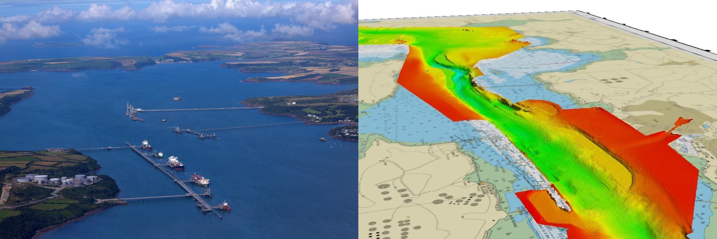
By working closely with the Port of Milford Haven, the UKHO was able to develop four HD ENCs covering the waterway of Milford Haven to help support safe navigation in this area, while taking into account the pilots’ local knowledge and specific navigational challenges.
The ENCs were compiled using detail-rich bathymetric surveys coordinated by the port and consultants Anthony D Bates Partnership LLP, which were conducted using a multibeam echosounder to capture high-fidelity data on the depth and nature of the seabed. The UKHO also collaborated with MHPA staff to test the ENC cells in the port’s marine navigational suite, enabling them to simulate changing weather conditions, tidal currents, ship traffic and other navigational hazards.
As a result, the UKHO’s cartographic experts were able to produce chart coverage of the area with one-metre contours, providing vessels with more navigable space to enter and exit the waterway. This has helped to address the navigational ‘pinch points’ and has enabled pilots to use parts of the channel that they would have been unable to in the past.
HD ENC coverage of Milford Haven Waterway is now available through ADMIRALTY Vector Chart Service (AVCS) as cells GB5DEQSC, GB5DEQSA, GB5DEQSD and GB5DEQSE.
Supporting future collaboration
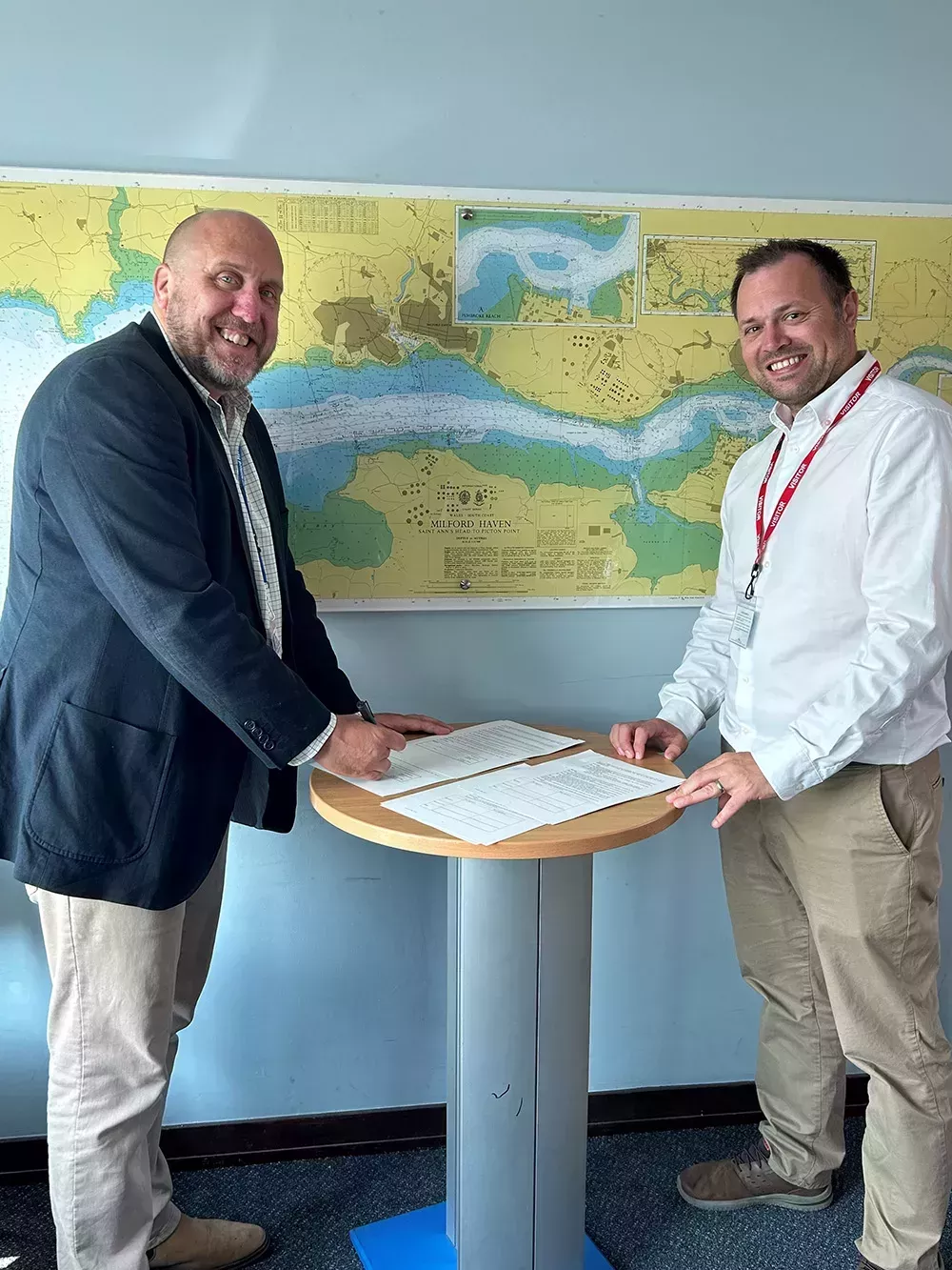
This work was made possible due to the ongoing collaboration between the UKHO and the Port of Milford Haven. The two organisations recently re-signed their port agreement in order to continue this collaboration and improve data exchange into the future.
In addition to developing high-density coverage of the area, the UKHO has also been working closely with the port to rescheme coverage of the area in readiness for the next technical generation of ENCs (using the S-101 data standard). This work involves using a standardised gridded scheme that will support interoperability with other data sets using the International Hydrographic Organization’s S-100 data standard.
Close collaboration with ports and harbours will become increasingly important as the UKHO continues to work towards the next generation of digital navigation products. In understanding the specific requirements and challenges of coastal areas and waterways, this can help inform future ADMIRALTY products and services to support safe navigation for mariners.

Name
Paul Marks
As Head of Ports Partnering and Engagement, Paul is responsible for developing and maintaining partnerships with UK data suppliers including ports and harbours. On behalf of the UK Hydrographic Office, Paul works to facilitate and improve data exchange for the benefit of both parties.