 Skip to main content

Seabed Mapping Service
Our Seabed Mapping Service gives users access to data from around the UK that has been collated, processed and validated by UKHO experts, helping create the right bathymetry data output to meet your needs. The ‘beta’ label means you’re looking at the first version of the new service. During this phase, we will be continually testing and improving the service.
Vertical Offshore Reference Frame
Vertical Offshore Reference Frame (VORF) allows geospatial data to be re-referenced between a number of vertical datums. VORF is a set of high-resolution digital models of reference surfaces such as Mean Sea Level (MSL), Lowest Astronomical Tide (LAT) and Chart Datum (CD) - all modelled with respect to the terrestrial reference frame used for GPS/GNSS positioning (ETRF89).
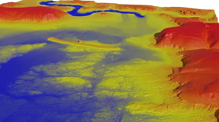
Why is bathymetry important?
Almost all activities in the ocean are underpinned by marine geospatial data. Bathymetric data is collected for many different reasons: sometimes as the primary focus as a planned or routine survey or sometimes as secondary data collected in order to enable other work to take place.
Bathymetry supports a wide range of applications including:
- Safety of navigation - gathered to strict standards using rigorous survey methodology to support maritime navigation
- Dredging - gathered to determine quantities of material during dredging activity
- Environmental and scientific study - used to understand different aspects of the marine environment, from protection of habitats to flood modelling
- Engineering and construction - used to aid spatial planning and construction projects, such as subsea cables, port construction and offshore energy infrastructure
If you have bathymetry survey data, contact us to find out how to share your data to help the wider marine community.
Our seabed mapping expertise
As a world-leading centre for hydrography, we are globally recognised experts in seabed mapping and have extensive holdings and services to help you get the right seabed mapping solution to support your marine decision making.
We have been accredited by MEDIN as the national Data Archive Centre for bathymetric surveys. Therefore, we have included access to relevant bathymetric surveys held in our Data Archive Centre as part of our ADMIRALTY Marine Data Portal. We also work as part of the Cabinet Office's Geospatial Commission and with partners across the UK's marine community to help improve data collection and collaboration across the sector.
Title
Specification documents
The guides below provide information on submitting your own survey data to the UKHO.