 Skip to main content

What is a nautical chart?
A nautical chart is a special-purpose map designed to support safe maritime navigation. Nautical charts provide a graphic representation of a marine area and adjacent coastal regions, including features such as water depths, navigational dangers, seabed features, aids to navigation, and more.
The UK Hydrographic Office (UKHO) produces electronic and paper nautical charts through its ADMIRALTY portfolio, including comprehensive chart coverage of the world’s commercial shipping routes and ports.
What are the different types of navigational chart?
Nautical charts are available in a range of scales according to the area it is depicting and the needs of the mariner. For example, large-scale charts contain much greater detail and are designed for navigating such as harbours, anchorages and narrow straits, whereas small-scale charts depict a much larger geographic region are therefore more suitable for planning.
Charts are available electronically or in a traditional paper format:
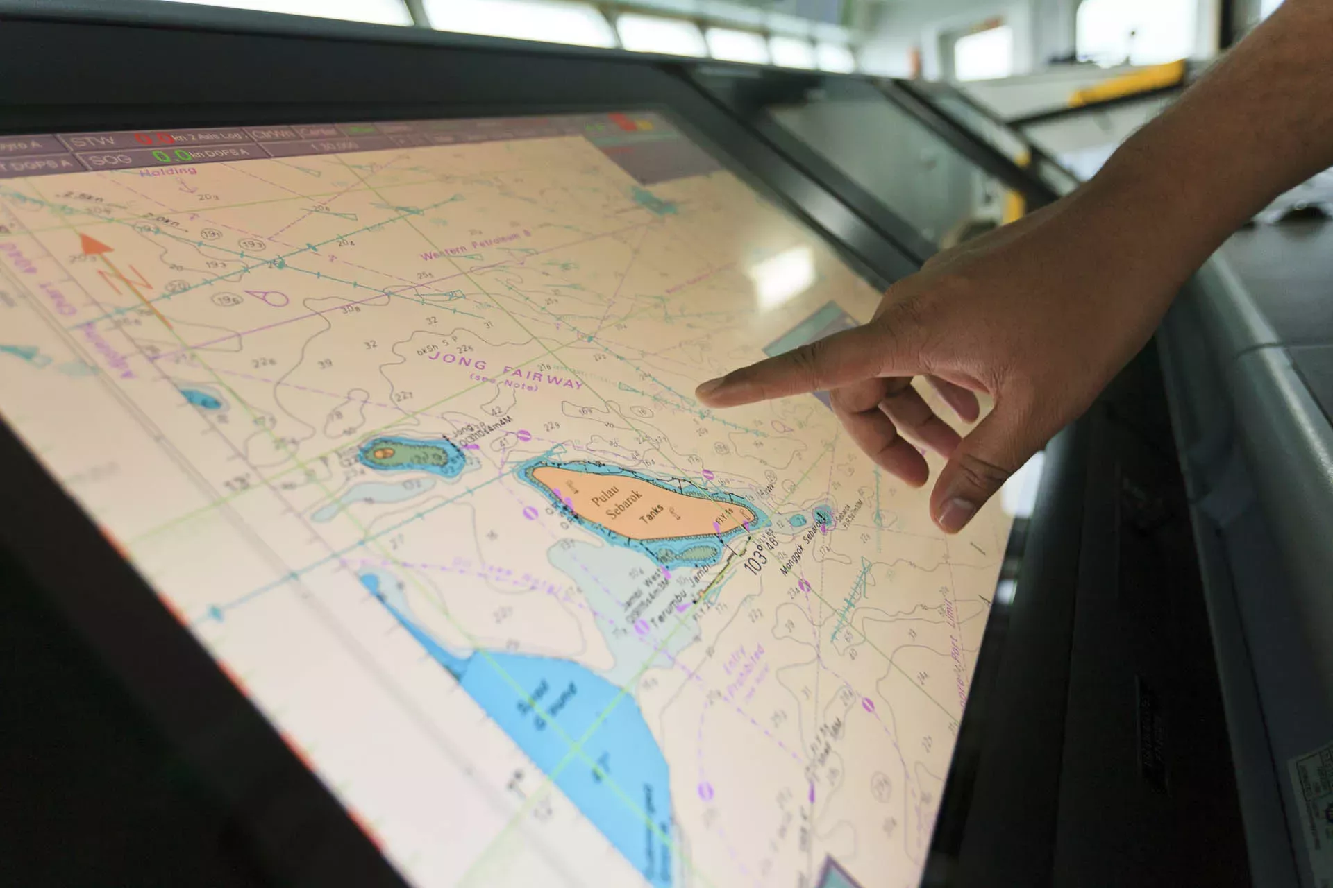
Electronic Navigational Charts (ENCs)
ENCs are official vector charts designed for use within an Electronic Chart Display and Information System (ECDIS). ENCs are fully interrogable and can be scaled according to the mariner’s needs. Using geo-referencing and real-time data, they enable the ECDIS to check and monitor a ship's route and warn if safety is being compromised.
The UKHO makes ENCs available through the ADMIRALTY Vector Chart Service (AVCS).
Raster Navigational Charts (RNCs)
RNCs are digital copies of Standard Nautical Charts, using the same familiar symbols and imagery of their paper equivalents. Raster charts are viewed electronically within an ECDIS or Electronic Chart System (ECS).
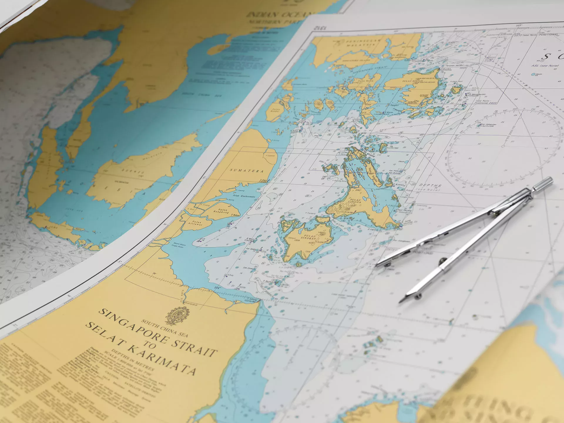
Standard Nautical Charts (SNCs)
SNCs are physical printed paper charts. These charts are printed using a high wet-strength paper designed to withstand the frequent use of pencils, erasers and drawing instruments that are used for planning routes, plotting positions or applying Notices to Mariners.
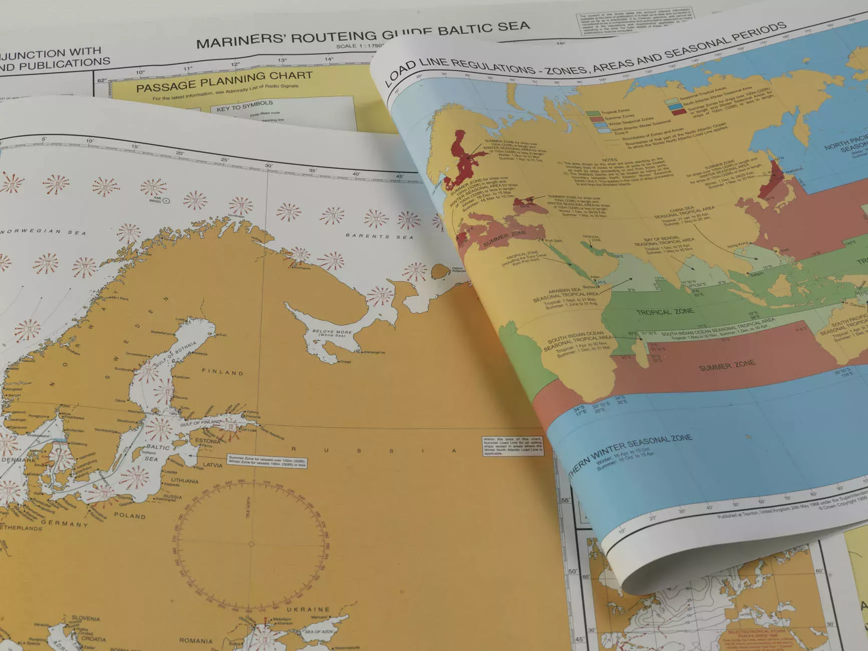
Planning Charts
A range of other specialist charts are available for route planning or plotting. This includes Maritime Security Charts, which contain safety-related information for areas of increased risk, and Mariners’ Routeing Guides, which are designed to support passage planning.
What does a nautical chart contain?
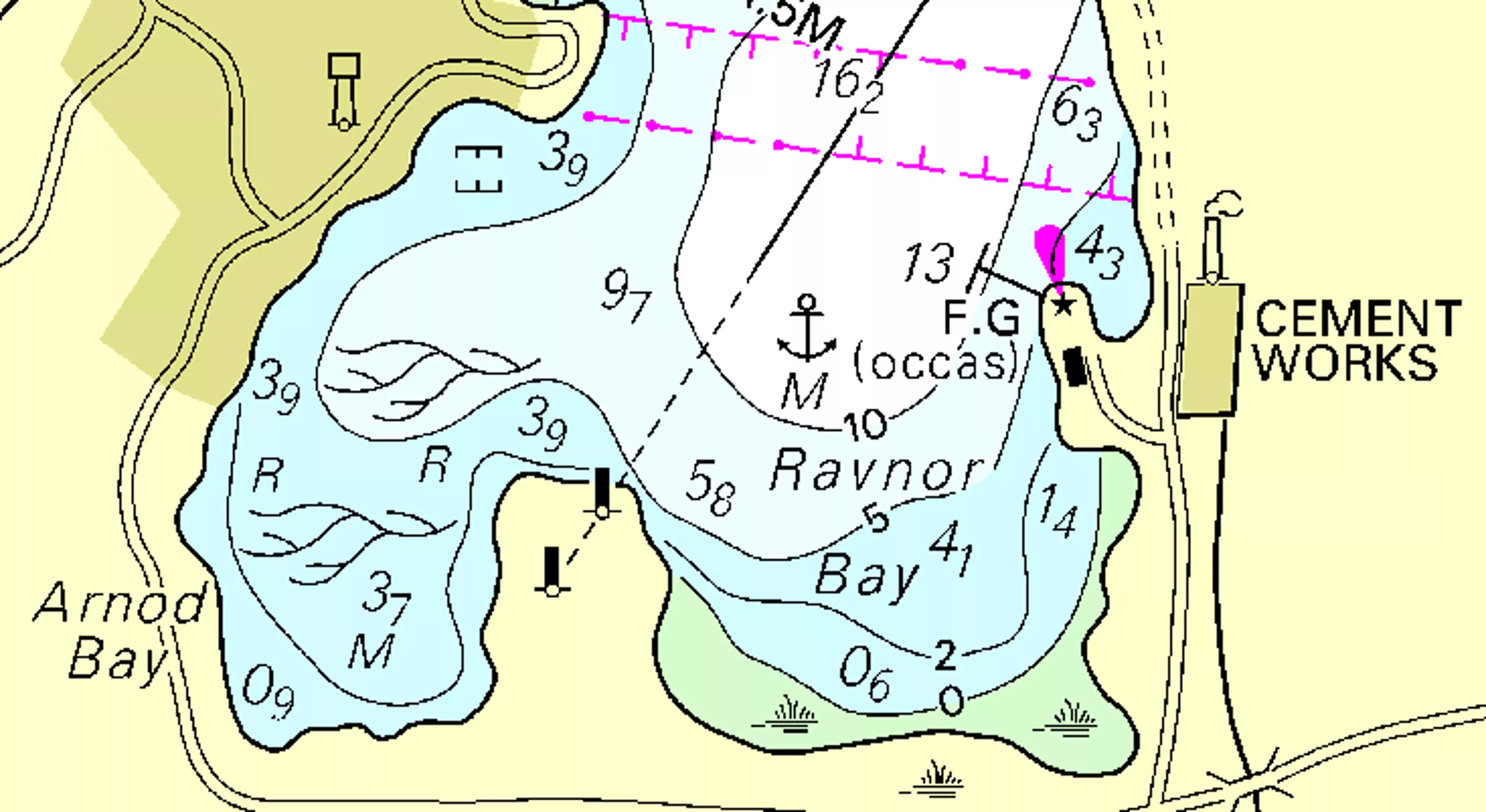
Nautical charts depict the depth and nature of the seabed, along with the navigational information mariners need to decide whether a route is safe.
Hydrographic offices compile this information from a range of sources, including hydrographic surveys that capture rich bathymetric data on the depth and nature of the seabed.
Data in charts include:
- Charted depths - known as ‘soundings’, and depth contours - lines that join points of equal depth
- Navigational aids, such as buoys and lights
- Navigational dangers, such as wrecks and obstructions
- Topographic data, such as landmarks and land contours
- Tidal information and surface currents
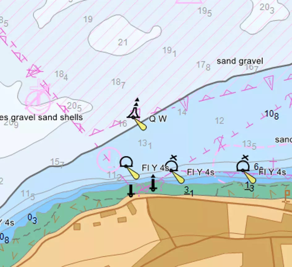
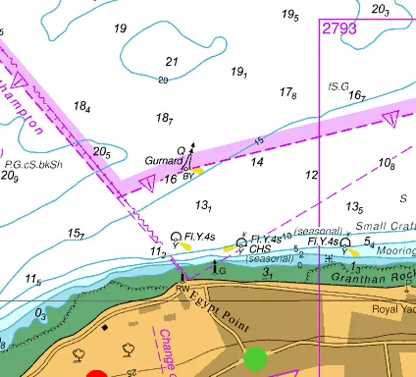
About nautical chart symbols
Charts use an internationally recognised set of symbols and abbreviations (as defined by the International Hydrographic Organization) to ensure they can be easily read and understood by mariners worldwide. ADMIRALTY charts use a standardised colour palette of white, blue, green and yellow to indicate water depths, land and intertidal zones.
More information on chart symbology can be found within our ADMIRALTY Reference Guides or our quick guide to understanding ENCs.
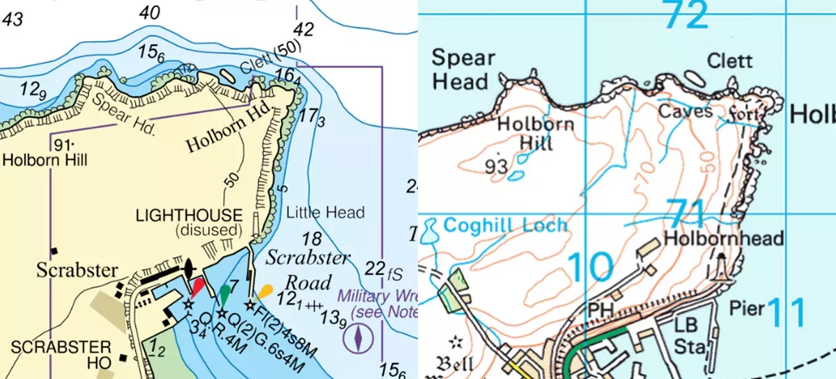
How does a nautical chart differ from other types of map?
While a map depicts detail on land that can be seen, a nautical chart depicts depths and features beneath the surface of the sea which the navigator has no visual means of checking. Nautical charts may include some topography, however this is only included where land is visible from seaward and where the information is of use for maritime navigation, such as prominent landmarks or coastal features.
Another key difference is the standardisation of nautical charts. While there are many varieties of land-based map, modern nautical charts all use a uniform standard in order to be widely understood by mariners across the globe and classed as compliant for navigation. This includes colours and symbols that comply with standards set out by the International Hydrographic Organization.
How are nautical charts updated?
As the safety of a ship is dependent on the accuracy of the charted information, it is important that charts are kept up to date. Chart updates are delivered to mariners via weekly Notices to Mariners (either temporary or permanent); for ECDIS users, these updates can be downloaded and applied electronically, for paper chart users, these updates must be applied manually by using specific chart correction tools.
Radio Navigational Warnings are used for items considered to be of immediate danger to navigation, such as new wrecks in traffic routes or oil rig movements.
Where can I buy nautical charts?
ADMIRALTY charts are available to purchase from one of our authorised distributors. We have a global network of experienced and trusted ADMIRALTY Distributors; to find a distributor, visit our ‘How to Buy’ page.