 Skip to main content

For many years, S-57 has been the standard data format used for the transfer of digital hydrographic data including Electronic Navigational Charts (ENCs).
Since S-57 was first adopted as the official standard in 1992, digital navigation has come a long way and transformed how mariners navigate at sea.
Today, greater connectivity is unlocking opportunities for more seamless data exchange, while the number of sources for hydrographic data is growing exponentially. To ensure all this data can be brought together and seamlessly displayed on Electronic Chart and Display Information Systems (ECDIS), it is important that new and existing data sets are standardised.
This is the challenge the International Hydrographic Organization (IHO) sought to address with their S-100 Universal Hydrographic Data Model. Emerging standards are being developed and tested that will enrich the way data is shared and displayed, offering a more complete picture of the maritime environment.
Below, we outline some of the new and existing standards and explain why they’re so crucial to ensure safe and efficient navigation at sea.
What is S-57?
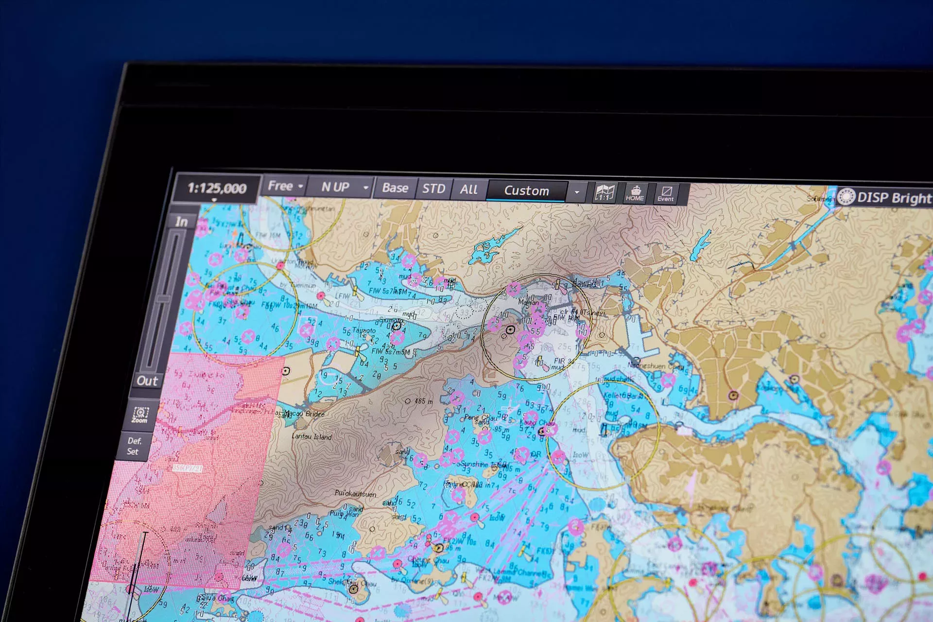
S-57 is the current data format used for the exchange of digital hydrographic data between national hydrographic offices, and for its distribution to manufacturers, mariners and other data users.
This specification defines how hydrographic offices construct an ENC for display in ECDIS, ensuring that all ENCs contain the chart information that is necessary for safe navigation.
When used alongside other data standards such as S-52 and S-63, this ensures that all ENC data is accurate, secure and interpreted correctly when used in a type-approved ECDIS to support safety of life at sea.
Other important hydrographic data standards
S-52
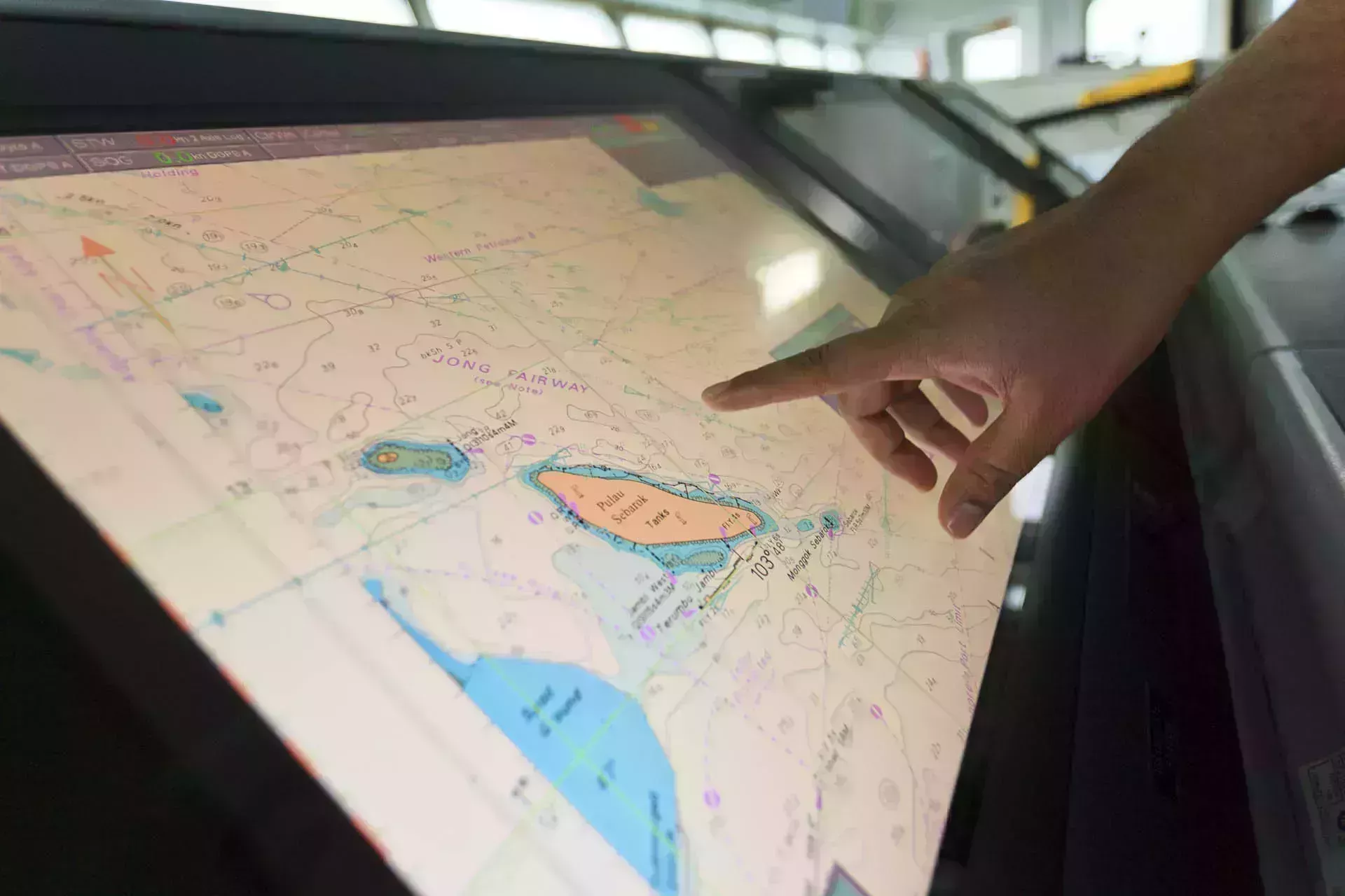
S-52 is a standard used by ECDIS manufacturers that determines how ENC data is displayed on an ECDIS screen through symbols, line styles, colours and other visual cues. This means that what the mariner sees on the screen is displayed in the same way across all approved makes and models of ECDIS.
S-58
S-58 sets out validation checks that must be performed on ENCs by hydrographic offices before they are released to the mariner at sea. This includes tests to ensure that there are no irregularities that could cause an ECDIS to malfunction, such as incorrectly intersecting geometry or depths plotted on land.
S-63
S-63 provides the standard for encryption of ENCs, so mariners can be assured the data is secure and comes from an official source. This standard covers protection against privacy, selective access (allowing customers to only view the cells they have been licenced for) and authentication (providing assurance the data has come from approved sources).
What is S-101?
S-101 is the latest product specification for ENCs. S-101 ENCs will provide a base chart layer upon which other interoperable S-100 based products can be overlaid, such as S-102 (Bathymetric Surface), S-104 (Water Level Information) and more.
You can read more about how we’re rescheming current S-57 GB ENCs into a gridded format in readiness for the transition to S-101 ENCs in our blog.
How does S-101 differ from S-57?
S-101 ENCs will not reengineer the characteristics currently found in S-57 ENCs. This standard has been developed in alignment with current ISO 19100 geospatial standards and will allow for a much more dynamic and interoperable display of data in ECDIS.
Improved mariner experience
Unlike S-57, the S-100 data model allows for a more dynamic data delivery mechanism and an improved mariner experience. This will include improvements such as a fully machine-readable catalogue system, removing the costly expense for engineers to come on board to upgrade a vessel’s ECDIS.
Easier updating
S-101 ENCs will also include an update feature functionality which will allow ENC producers the ability to highlight any features that have been added, deleted or modified in an ENC update, saving the mariner time whilst route planning.
Complex attributes
The new standard will introduce enhanced complex attributes and geometrical concepts that were not possible using the S-57 standard. This will include composite curves to provide a more realistic presentation of the physical world.
Dynamic under-keel clearance
Mariners currently rely upon soundings and depth areas within an S-57 ENC to generate a static safety contour. S-100 will enable mariners to automatically generate a dynamic under-keel clearance value within their ECDIS. By overlaying S-101, S-102, S-104 and S-111, mariners will have an under-keel clearance value that accounts for tidal levels, surface currents and high-resolution gridded bathymetry. This will allow for a more accurate and dynamic safety contour to be set within ECDIS – enhancing safety and opening up navigable areas within ports and channels that previously would have been too shoal for some vessels to access.
To support with the development and practical use of S-101 ENCs, we have produced a trial data set to match the existing S-57 GB ENC scheme. This is available to download for free via the ADMIRALTY Marine Data Portal.
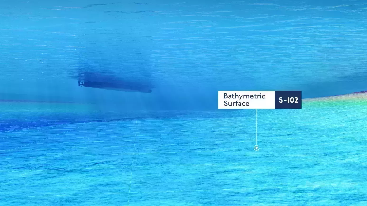
What is S-102?
S-102 is the product specification for bathymetric surfaces, containing high-resolution profiles of the seafloor in a regular grid structure. These high-resolution profiles will offer users a more granular view of the seafloor, helping reduce the risk and complexity for ships entering and exiting confined waterways.
When combined with other S-100 data sets, S-102 data will offer a more complete picture of the marine environment to support greater precision when navigating at sea.
A trial data set for S-102 Bathymetric Surface, produced by the UK Hydrographic Office, is available to download for free on the ADMIRALTY Marine Data Portal.
What other S-100 standards are being developed?
There are many other data products included within the IHO’s S-100 Universal Hydrographic Data Model. Our short video below gives an overview into these standards:
Free trial data sets to explore
In support of the development, testing and use of future S-100 data products, we’ve created a range of free trial data sets via the ADMIRALTY Marine Data Portal:

Name
Thomas Mellor
As Head of Technical Partnerships, Tom leads the UKHO’s collaboration with technical partners including Original Equipment Manufacturers (OEMs) to enable the development of e-navigation products and S-100 solutions for Electronic Chart and Information Display Systems (ECDIS). Tom works at the forefront of the latest ‘next generation’ navigation technologies to support the implementation of new standards that can help improve safety, efficiency and optimisation.